watersheds.org the world in your watershed search
homeOnline Casinowhat's newabout ussite mapcontact us
 

Spring River Galloway Creek Nature Park Galloway Park map

Map of Galloway Creek Nature Park    In Progress

Directions to the Park

Click the numbered areas on the map
Galloway Park Map
map legend
     picnic area
The parking lot area includes a rain garden. The community building will house
an interpretative center featuring natural, historical and cultural aspects of the park.

return to map


The picnic pavilion will be available for local company picnics, school class and family reunions and
other groups wanting to gather for different occasions. It will also double as an outdoor classroom
for study and observation of the park.

return to map


This area has been planted with native grass seed such as Buffalo grass, Indian grass and Little Bluestem.

return to map


return to map


The construction of this footbridge included a streambank restoration project.

return to map


     This footbridge overlooks the beaver pond.

return to map


Directions to the Park


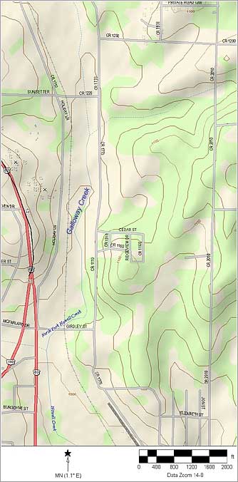
Take Business 63 (Porter Wagoner Blvd) north, turn right on Girdley St (between Toyota and Morlan Shell Ford, near City Hall), continue under the railroad bridge and turn left at the top of the hill on CR 1770. The park is about one half mile on the left.

View topo map image


return to Galloway Park main page

Opening Celebration with demonstration of urban conservation practices

Galloway Park Map with photos and directions

Photo Gallery: some of the people who have made Galloway Park possible.

Earth Day Workday at the Park


LWCF
The funding source for the development of Galloway Creek Nature Park is the U.S. Department of Interior, National Park Service, Land and Water Conservation Fund (LWCF). The LWCF program in Missouri is administered by the Missouri Department of Natural Resources, Division of Parks and Historic Preservation.


Top


community building, picnic area, rain garden picnic pavilion and outdoor classroom native grass area covered bridge, observation deck footbridge with streambank restoration footbridge and beaver pond