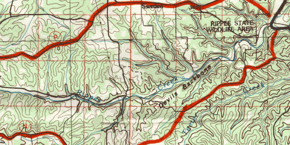
Roads
County roads run along the upper half of the creek. There is a gravel
crossing at the mid-point, and P Highway crosses Rippee at Girdner.
Watershed Size: About 18 square miles.
 Topography
Elevation varies from 1,360 feet above sea level on Hilo Ridge to 800
feet at the confluence with Bryant Creek. Maximum relief is 560 feet.
Stream Flow
Rippee Creek flows perennially from near Girdner for about 7 miles.
Bryant Flow Contributor Rank
Rippee Creek is the fourth largest tributary of the Bryant.
Landscape & Special Features
Much of the watershed has steep slopes with moderate slopes at the
head of the watershed near Squires. There are large areas of pasture
on the broad ridges near the mid-point, above Girdner, and along the
creek valley. Much of the rest of the watershed is wooded. Rippee
Conservation Area includes 418 acres of public land along Bryant
Creek at the mouth of Rippee Creek.
Topographic Maps
Wasola and Rockbridge.
School Districts
Ava, and a small bit of Skyline.


