Karst Features in Bryant Watershed
 |
 |
| Tom Brown's Cave, south of Rippee Access. | Hodgson Mill Spring |
 |
 A sinkhole in a field south of Norwood. The area around Norwood has the largest number of sinkholes in the Bryant watershed. You can see the area circled on this map. It's just north of Dry Creek and Prairie Hollow Creek. |
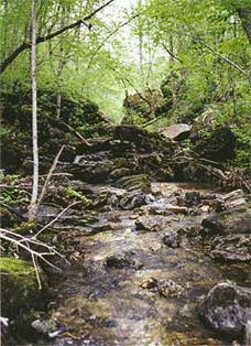
| A rocky stream in the headwaters area of Bryant Creek, in the Cedar Gap Conservation Area. Bryant Creek is a losing stream in its upper reaches. | More about sinkholes: Touring Area Sinkholes; Sinkholes Grow Great Trees. |