
|
|||
|
|
|||
 
Watersheds
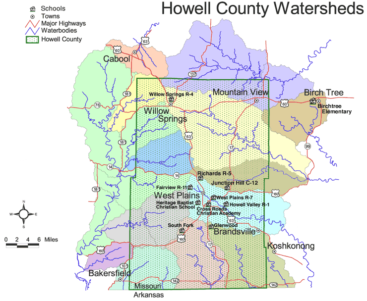
Base map courtesy of the Missouri Department of Natural Resources. This is the Web site of the Bryant Watershed Project, based in West Plains, Missouri. Our site is a toolkit for exploring the Bryant Creek, North Fork, Eleven Point and Upper Spring watersheds in the southern Missouri Ozarks. Learn more. |

