|  
Local Watersheds  Little North Fork Watershed Little North Fork Watershed Little North Fork Watershed 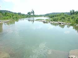 |
From its source in a valley southwest of Squires in southern Douglas County, the Little North Fork River flows only 20 miles to its end in southwest Ozark County. This picture shows Haskins Ford Conservation Area, off County Road D-863. This is the last place the stream flows freely before entering Bull Shoals Lake. | | Bull Shoals Lake was constructed on the White River in the 1940s. The lake flooded the lower third of Little North Fork's former channel. Before that it was several miles longer, and fed into the North Fork River. Today its watershed covers 158 square miles. 84 square miles, or 53%, are forested. The Mark Twain National Forest covers more than half the watershed. Grassland covers 70 square miles, or 44% of the watershed, and surrounds the forested portion. Thornfield, with a population of 350, is the only incorporated town in the Little North Fork watershed. | 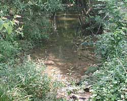 | Little North Fork river about a mile downstream from its source. It will not flow year round for another four miles. | 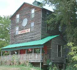 | A family has turned Hammond Mill, one of the old Ozark County mills, into their home. Years ago, the river changed its course, leaving the mill high and dry, and unusable. | 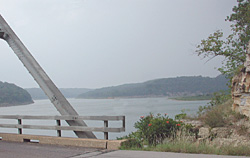 | Bull Shoals Lake. The low bluffs across the lake used to be along one side of the Little North Fork River. |

Sources: Missouri Atlas and Gazetteer,DeLorme, Yarmouth, Maine, 1998, page 63.
Missouri Ozark Waterways,Oz Hawksley, Missouri Department of Conservation, Jefferson City,1997.
Missouri Resource Assessment Partnership, Land Cover by Hydrologic Unit.
Missouri County Fact Sheets,Evelyn Cleveland, MU Outreach and Extension, 1999. |