|  
Places  Local Watersheds Upper Gasconade Watershed Local Watersheds Upper Gasconade Watershed
Upper Gasconade Watershed 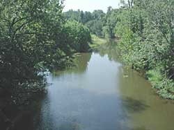 |
The watershed of the Upper Gasconade River is just north of the Ozark Divide. This long plateau divides streams flowing north to the Missouri River from those flowing south to the White River, like the Bryant and the Finley. The Gasconade winds its way northeastward for over 300 miles through the state of Missouri, until it reaches the Missouri River. | | The first third of the Gasconade is the Woods Fork of the Gasconade. It has its source in Webster County about 7 miles north/northwest of Cedar Gap. Another Branch, the Lick Fork of the Gasconade, begins just two or three miles south. After flowing several miles apart, the two forks meet after about 20 miles on the south side of Hartville. Then the river flows for another 28 miles and meets Beaver Creek in northeastern Wright County, near the Laclede County border. | 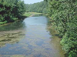 | Woods Fork of the Gasconade on the south side of Hartville. Notice algae floating in the water. That's a sign that there may be excess nutrient runoff, likely in this area to be from cattle. | | The area of this watershed is 360 square miles.133 square miles, about a third of it, are forested. 223 square miles, about two thirds, are in grassland. This is an agricultural area, grassland and cattle country. | 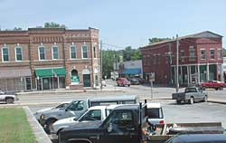 | Hartville, the Wright County seat, with about 600 people, is the only sizeable town within this watershed. Mansfield (population about 1600), Norwood (population about 600), and Mountain Grove (population about 5000) are all along the Ozark Divide on its southern edge, along Highway 60. | 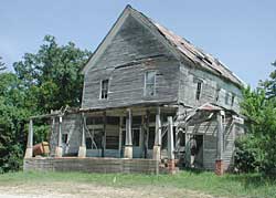 | This was the store at Rayburn, about 10 miles east of Hartville. It had the concrete loading dock out front and room to store plenty of bulky items, like feed. It was on Highway 38, an important highway, and was about two miles from Grimes Mill on the Gasconade. Grimes Mill Dam, 13 miles downstream from Hartville, is still there. Better roads and better vehicles came along in the 1950's and put the old stores out of business. |

Sources
Missouri Atlas and Gazetteer,DeLorme, Yarmouth, Maine, 1998. page 53.
Missouri County Fact Sheets,Evelyn Cleveland, MU Outreach and Extension, 1999.
Missouri Resource Assessment Partnership, Land Cover by Hydrologic Unit.
Missouri Ozark Waterways,Oz Hawksley, Missouri Department of Conservation, Jefferson City, 1997. |