
| |||
| | |||
  Places | |||||||
Bryant CreekThe total length of the Bryant is about 60 miles, from its headwaters in Wright County until it flows into the North Fork just above Norfork Lake in Ozark County. It is floatable for 42.6 miles from Vera Cruz to the North Fork. | |||||||
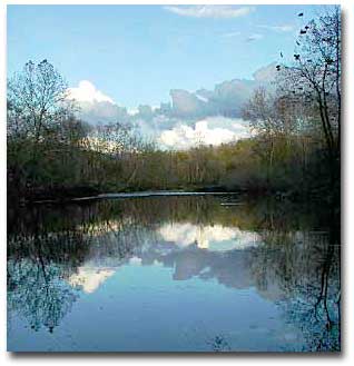 Bryant Creek is a typical losing stream. It begins as an intermittent flow fed by several small drainages. The headwaters lie within what is now the Cedar Gap Conservation Area, at an altitude of about one thousand feet above sea level. At Bryant Spring, near Ava, it becomes perennial for several miles, and around Dry Creek, it disappears underground. Just above Tarbutton Creek it resurfaces, and resumes its flow as a perennial (year-round) stream. At its confluence with the North Fork, its altitude is about five hundred and sixty feet above sea level. Bryant Creek flows through the three Missouri Ozarks counties of Wright, Douglas, and Ozark until it joins the North Fork of the White River. The Bryant Creek watershed contains about 373,600 acres over 584 square miles. This is a beautiful hardwood and pine forested area with considerable land cleared for raising cattle. Latest figures on land use: grassland (includes pasture and hay forage crops): 141,233 acres, 221 square miles; forest: 227,032 acres, 355 square miles. |
| ||||||
| Source: Missouri Resource Assessment Partnership (MoRAP) land cover data. Written by Hank Dorst and Peter Callaway. Photo by Peter Callaway. | |||||||
 Bryant Creek